North Dakota’s longest State Highway is Highway 200, and it stretches over 400 miles from the Red River near Halstad, Minnesota to the Montana border at Fairview. As we’ve been exploring North Dakota’s vanishing places since 2003, it’s a highway we’ve found ourselves on again and again, and we’re due to show appreciation for a road that will take you to so many amazing places.
Feel like a hypothetical roadtrip? Let’s start in the East.
Start at I29 and proceed west on State Highway 200. Mayville/Portland is a great place to stop for a bite if need be. Continue west on Highway 200, and drive for about 15 minutes, then head south, for Blabon and Sherbrooke, in Steele County, just a few miles off 200.
In Sherbrooke, you’ll find a true ghost town that was once the seat of Steele County but had it snatched away by business interests who bemoaned Sherbooke’s lack of a railroad or navigable river. President McKinley even stayed at the Sherbooke House Hotel once in 1896, but today, there are only a few standing homes and foundations of former businesses remaining in Sherbrooke.
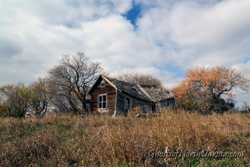
Blabon, the first place we ever visited in 2003, is a tiny community with a handful of residents, several abandoned homes alongside a few inhabited ones, and perhaps one crumbling house that looks like it might be an original structure.
From Blabon, head northwest to rejoin Highway 200 at Finley and proceed west to the former…
Finley Air Force Station

Finley Air Force Station, like the Minot and Fortuna Air Force Stations, was conceived as a Ground Control Intercept Station designed to detect incoming Soviet bombers in any potential World War III Scenario. Today, the site has become a landfill.
From Finley, head south on 200 again and follow the signs as it turns west. Just a few miles east of Cooperstown, we come to Washburn Township Bridge, a cranky old automobile bridge that today serves most faithfully as a fishing pier.
Washburn Township Bridge, near Cooperstown

After dropping a line at Washburn Township Bridge, proceed west on ND 200 through Cooperstown, another great place to get a bite to eat if necessary, and, if you feel like a detour, this next place stands just south of town along County Road 19.
Shepard View

Shepard View is an estate built in 1905 by an Englishman, David Marson, an early settler to Griggs County.
Next, rejoin Highway 200. Continue west until you arrive at…
James River Church

The James River Landmark Church stands atop a hill right next to State Highway 200, and you won’t be able to miss it. The church was reportedly founded in 1919 and closed in 1969. Today’s it’s boarded up and locked, but it’s maintained in nice condition otherwise.
Continue west, through Carrington, where Highway 200 becomes concurrent with US Highway 52 for awhile, and detour north by a few miles to visit…
Cathay, North Dakota

The 2010 Census tallied 43 people in Cathay, North Dakota, and we found vacant buildings like the old Post Office and School, as well as a number of churches, to be quite photogenic.
Just a little further west on Highway 200 you’ll come across Heaton, not even a mile north of the road.
Heaton

Heaton, North Dakota, last time we checked, was down to a single resident, Brian Miller, a young man who grew up in the area and eventually bought a house in Heaton. When his neighbors moved-out, he found himself the only remaining resident of Heaton. Gordon Kahl is buried in the Heaton Cemetery.
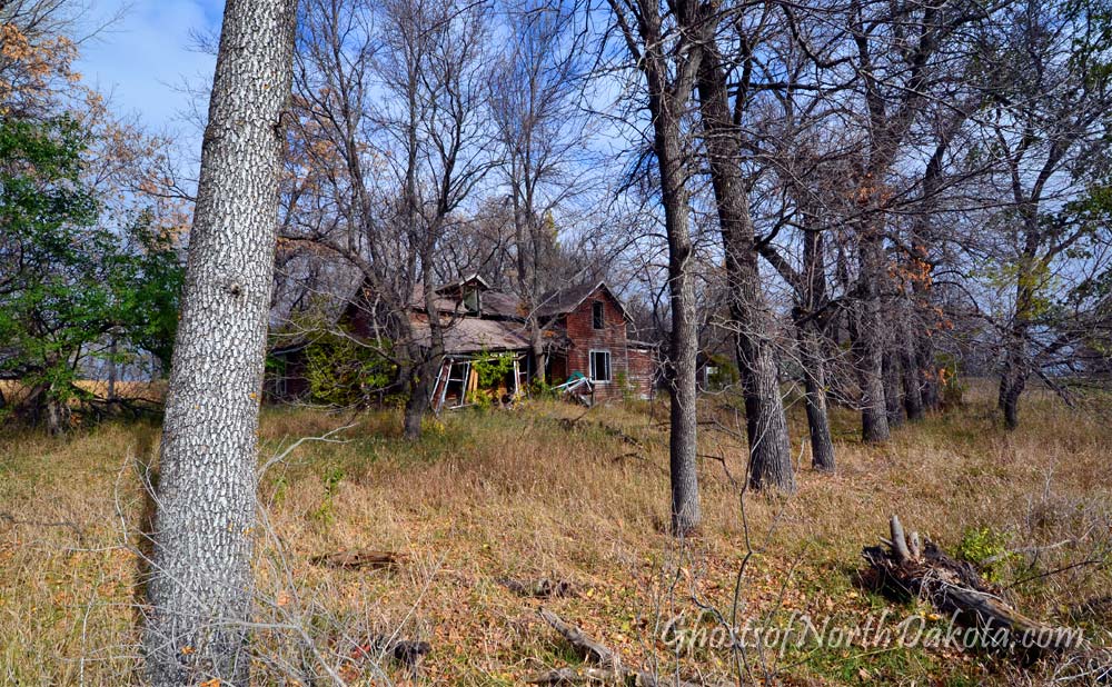
Chaseley, North Dakota

Chaseley is next as you continue west along ND 200. We met a nice local property owner on the day we were there, and she gave us some nice backstory on the places that remain in Chaseley.
When you’re done in Chaseley, head west again on Highway 200. When you get to Denhoff, head north of the highway for about 10 minutes and visit…
Lincoln Valley
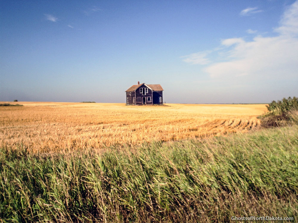
Lincoln Valley, North Dakota is another true ghost town with zero remaining residents. Joe Leintz, the last person to live in Lincoln Valley, left in the 1970s. It’s a place we’ve visited on multiple occasions and one of our favorite true ghost towns.
As you continue west on ND 200, you’ll have a relaxing cruise through the backroads of North Dakota before you get to the next place on this list.
Sanger
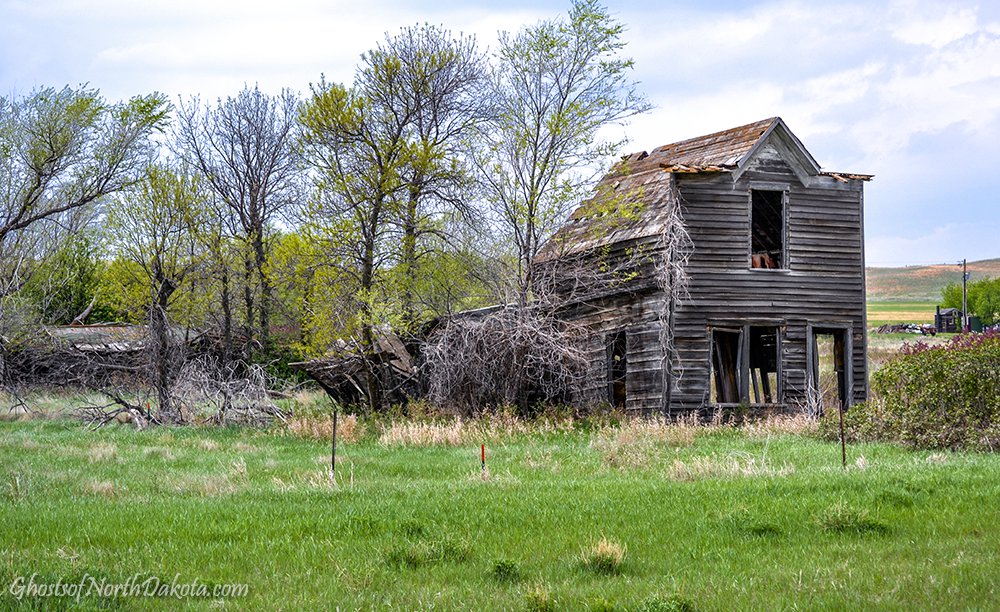
Sanger, North Dakota is just south of Washburn and Highway 200 on the west bank of the Missouri River. When we first visited Sanger it was a ghost town, but we returned a few years later to find two gentlemen had moved into town and were fixing up a couple of the houses. So, as of this writing, the population is two. Unfortunately, the County House (shown above), a former boarding house for travelers making the two-day journey by wagon from Minot to Bismarck, has recently collapsed.
Next, proceed west on State Highway 200 to Halliday.
Lost Highway

Take a detour north of Highway 200 at Halliday, head north of Twin Buttes, and take a hike down an abandoned North Dakota Highway.
Before the damming of the Missouri river, this highway led to Elbowoods, North Dakota, and the original location of the Four Bears Bridge. When the Missouri was dammed, this river valley filled with water to create Lake Sakakawea, Elbowoods was abandoned, the bridge was floated to a new location, and a crossing here was no longer possible except by ferry. With the lack of traffic, a little more than a mile of highway fell out of use, and now it’s a lost highway to the bottom of Lake Sakakawea.
Werner

Rejoin Highway 200 and proceed west until you come to Werner, a quiet spot on the prairie with a few vacant homes and an impressive single-truss bridge over Spring Creek on the southwest edge of town.
Enjoy another leisurely stretch of backroad cruising until 200 joins US 85 northbound and proceed to Grassy Butte. Make sure you check out the sod post office while you’re there.
Schafer Jail

Continue west on ND 200 and deviate by a few miles to visit Schafer, just east of Watford City. The Schafer Jail was the site of the last vigilante lynching in North Dakota. Continue on State Highway 200 to…
Charbonneau

Charbonneau is a town with an interesting history and beautiful vistas punctuated in places by picturesque vacant structures clustered around the former rail line, and one apparent resident whom we did not see on the day we were there.
If you follow ND 200 to its end, just down the road from Charbonneau, at the Montana border, you’ll have to stop and see this next place.
Fairview Lift Bridge and Cartwright Tunnel

Fairview Lift Bridge and Cartwright Tunnel is on borrowed time as a combined attraction. Although the bridge is nicely maintained as a tourist attraction, the tunnel is badly in need of a restoration, and in danger of implosion. See it while you still can. (Update: The tunnel has undergone a rebuild.)
It can’t go without mentioning that Fort Buford and Fort Union are in this same area too, so if you’re in the mood for some more traditional sightseeing, check them out.
This has been a hypothetical roadtrip featuring a few places we’ve visited over the years. It goes without saying that, if you should decide to visit some of these places, that you have appropriate permission to visit, or you photograph from public property with zoom lenses etc… Take only pictures and leave only footprints.
What’s your favorite place along North Dakota 200? Please leave a comment.
Photos by Troy Larson and Terry Hinnenkamp, copyright © Sonic Tremor Media

Wow! Great idea! What a road trip. I presume it would be best to make this trip during the “more endurable” ND Seasons*, and plan to sleep by the road, or use some sort of travel van. Pack food and gas perhaps as well. When I was a kid in the 1950’s traveling ND with my parents, many of these small towns had a gas station/store/diner/saloon, or something like that, every 50 miles or so. From reading your various posts about shrunken/evaporated towns in ND, I would presume that those days are long gone and one would be wise to either stay on the main roads or plan ahead, in detail…
* Fall/Spring
LikeLike
Was stationed at Finley AFS as well as Fortuna AFS and Opheim, MT AFS 1970-72. Sad to see Finley is now a landfill. Visited there about 20 yrs. ago or so and it seemed that they were using some of the equipment for air traffic control. Google Earth shows Fortuna as just a trash pile of debris & Opheim as well. (Always thought all 3 would be there “forever”).
LikeLike
About 18 months ago, I did this trip in reverse, from West to East, but I started here in Sandpoint, Idaho and went all the way to Ada, MN. Ada is my daughter’s namesake, and I though it made for a good destination.
I didn’t make much time to stop at the ghost towns, but I did see a ton of beautiful countryside and wonderful small towns.
BTW, Mr. Freeburg, no need to worry about finding provisions along the way. There are many more fully populated and functional towns in ND than there are ghost towns. Most of them even have running water and electricity 😉
LikeLike
Long Time No Article: I was worried Mr. Larson himself became a ghost. 🙂
LikeLike
Same here.
John M. from Massachusetts.
LikeLike
Thanks for the road trip! I have driven almost the entire length of ND200, in the 1980’s.
LikeLike
Its worth mentioning that Sanger is south of 200 alternate. After visiting Sanger, backtrack to US 83 & head north to regular 200 then head west. This will take you to the Garrison Dam & through the boom towns of Riverdale & Pick City
LikeLike
Wonderful pictures!! I remember the names of the towns and visited them many years ago.
LikeLike
For a new curiosity, how about going south on ND 48 from ND 200 between Washburn and Hazen. A bit before the town of Center, is the newly established “Scientific Geographical Center of North America.” The previous center is in a slough west of Kilgore Lake on 21st Avenue NE, south of US 2 on the way to Orrin. The cairn honoring that site is in Rugby but only because it’s the county seat.
LikeLike